The Rise of Drone Surveys
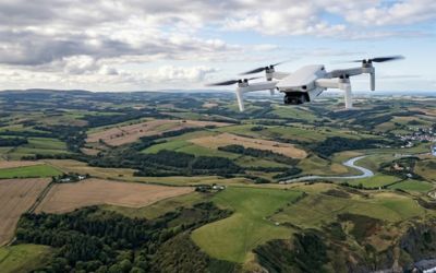
Drone technology has revolutionised land surveying in Kenya. Unmanned Aerial Vehicles (UAVs) equipped with high-resolution cameras and LiDAR sensors can map large areas in a fraction of the time traditional methods require.
When to Use Drones
Drone surveys excel in these scenarios:
- Large area topographic mapping (5+ acres)
- Construction site progress monitoring
- Volumetric calculations for mining and earthworks
- Environmental and vegetation mapping
- Areas with difficult terrain access
When Traditional Surveys Are Better
Traditional RTK GPS and total station surveys remain superior for:
- Boundary surveys requiring sub-centimetre accuracy
- Title surveys for Ministry submission
- Small residential plot surveys
- Areas under dense tree canopy
Cost Comparison
For areas under 2 acres, traditional surveys are typically more cost-effective. Above 5 acres, drone surveys offer significant savings — often 40-60% less than traditional methods while delivering richer data outputs including orthomosaics, 3D models, and contour maps.
Need a survey?
Get a free quote from our licensed team within 24 hours.